JBA Consulting
Challenge
Thorne, Crowle and Goole Moors Water Level Management Plan
Location: Thorne, Crowle and Goole Moors
Solution
Taking such a complex scheme from baseline assessment through to implementation involved a number of stages, including initial
assessments and concept design work, embarking on an extensive stakeholder engagement scheme and the installation of an
Archimedes screw pump.
However, one of the main innovations for this project was the creation of an "electric bog", which allows water levels across the site
to be managed remotely. Achieving this required the use of innovative technology, telemetry, water level control structures, contour
bunding and vegetation management, to monitor and control the water levels on the bog in real time.
To implement this the mire was subdivided into a series of compartments, each of which was bunded with a fixed output weir
controlling the water depth throughout the compartment. Groups of these newly created compartments were then linked together in
chains downstream with piezometers measuring water levels at set points within the chain. This information is then sent via radio to
a central system, which is connected by a mobile phone signal to a central programmable database. A series of tilting weir
structures to control the flow of water through the chains of compartments and, at the very bottom of the system, a pumping station,
is also connected to this central database.
The newly installed structures are fitted with water level monitoring and are pre-programmed to respond in set ways when rainfall
amounts are recorded or when water levels in compartments reach specific levels at certain times of the year.
Client/ Partner: Tween Bridge Internal Drainage Board
In 2009 we were tasked by a consortium of Internal Drainage
Boards (IDBs) to produce and implement a £2.9 million Water Level
Management Plan (WLMP) covering Thorne, Goole and Crowle
Moors, England's largest terrestrial Site of Specific Scientific
Interest (SSSI).
Home to a number of rare species, the mire had been damaged by
several hundred years of peat extraction and the aim of the WLMP
was to identify restoration measures to bring the site back to a
favourable condition. This included ensuring the correct depth of
water required to permit the growth of Sphagnum mosses was
maintained across the site, despite its varying topography.
The complex nature of the site and its location posed further
challenges when designing and implementing the restoration plan.
With the area recognised as an SSSI, covering three counties, and
owned by 22 separate landowners, any plans could not be
implemented without significant stakeholder engagement.
Therefore, implementing a plan across the whole site had to
consider the sensitivity of the site, the views of a range of
stakeholders, and the permission requirements that the complex
pattern of administration brought.
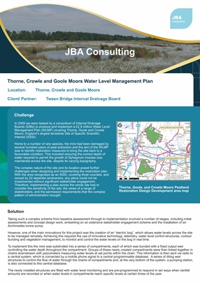
Thorne, Goole, and Crowle Moors Peatland
Restoration Design Development area map