JBA Consulting
We were commissioned to undertake a Flood Risk Assessment to
support the Planning Application and discharge of planning
conditions for a proposed new car park located in the functional
floodplain at Coventry and Warwickshire University Hospital in
Coventry.
The proposal will provide an additional 1600 new car parking
spaces to the hospital staff north of the confluence between the
Withy Brook and the River Sowe.
- The site is situated within Flood Zone 3 and Flood Zone 2
- The site is at low to medium risk of surface water flooding
- The site was considered to be at a high risk of groundwater
flooding
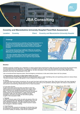
Challenge
Coventry and Warwickshire University Hospital Flood Risk Assessment
Location: Coventry Client: Coventry and Warwickshire University Hospital
Solution
Detailed hydraulic modelling was undertaken to clearly assess flood mechanisms within the car park and ensure the proposal does
not exacerbate flood risk elsewhere. Throughout consultation with the Coventry and Warwickshire University Hospital Trust,
Coventry City Council and the Environment Agency, we also developed a flood response plan involving cutting edge telemetry,
tailored to the flood risk classification of the site.
Like conventional flood response plans, flood emergency procedures on site were broken down into four phases.
1. Preparedness, focusing on steps taken before an event
The production of the flood response plan is a preparedness action in itself. Identifying risks and specifying actions to reduce these.
The plan provides a step by step guide of how to respond to a flood event.
a. Zoning
To optimise flood evacuation procedures, the car park has been split into three zones. Blue, Red and Green with clear signage to
mark each zone. This can then be used to evacuate each zone one by one (phased), allowing higher risk areas to evacuate first
and prevent overwhelming infrastructure from a mass evacuation.
b. Evacuation Routes
A clear evacuation route has been provided to show the
safest route out of the hospital onto the main roads, where
cars will head to the designated emergency overflow car
parks. This will also prevent confusion, ensuring the hospital
infrastructure is not overwhelmed. A clear route avoiding
evacuation traffic has also been considered to allow
emergency services to access the site without getting
caught in the evacuation traffic.
c. Signage
In order to ensure users of the car park are aware of the risk
it was recommended that signage be installed within the car
park highlighting this risk. This also includes the coloured
zones and the installation of depth marker boards to assist
site managers in decision making.
d. Crash Barriers
In order to limit the spread and damage of vehicles that may
be mobilised by fluvial action, crash barriers were designed
to limit the mobility of vehicles under fluvial conditions.