mark.lawless@jbaconsulting.com
www.jbaconsulting.com
Get in touch
Benefit
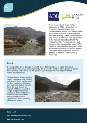
While data and analytics at this
scale does not provide detailed
solutions, the tool can be used
to steer investment decisions
and technical studies that will
have the best chance of
impact. NIRA can be used to
weigh-up combinations of
measures that would provide
the equivalent level of risk
reduction to traditional
approaches, whilst providing
greater co-benefits.
A set of opportunity maps for four
categories of IFRM - property level
protection, dykes/embankments,
nature-based solutions (runoff interception,
floodplain connection, riparian planting)
and flood warning - were also developed
and used in combination with adjustments
to the risk calculation to estimate the
relative benefits. The outputs were built
into an on-line mapping App called NIRA
(National Integrated Risk Analytics), which
visualizes the data produced and allows a
user to explore the potential costs and
benefits of different combinations of
measures.
By using NIRA, it was possible to identify those districts/regions in Nepal that are at
greatest risk of flooding. More importantly, it is a powerful tool that is being used to identify
those districts where there are the greatest opportunities with respect to IFRM and
nature-based solutions.