Solution
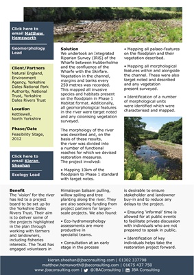
We undertook an Integrated
Riparian Survey (IRiS) of the
Wharfe between Hubberholme
and the confluence of the
Wharfe with the Skirfare.
Vegetation in the channel,
margins and banks every
250 metres was recorded.
This mapped all invasive
species and habitats present
on the floodplain in Phase 1
Habitat format. Additionally,
all geomorphological features
in the river were target noted
and any colonising vegetation
surveyed.
The morphology of the river
was described and, on the
basis of these results,
the river was divided into
a number of functional
reaches for which we devised
restoration measures.
The project involved:
• Mapping 10km of the
floodplain to Phase 1 standard
with target notes.
• Mapping all palaeo-features
on the floodplain and their
vegetation described.
• Mapping all morphological
features within and alongside
the channel. These were also
target noted and described
and any vegetation
present surveyed.
• Identification of a number
of morphological units
were identified which were
characterised and mapped.
Himalayan balsam pulling,
willow spiling and tree
planting along the river. They
are also seeking funding from
project partners for largerscale projects. We
also found:
• Eco-hydromorphology
assessments are more
productive in
specialist teams.
• Consultation at an early
stage in the process
is desirable to ensure
stakeholder and landowner
buy-in and to reduce any
delays to the project.
• Ensuring 'informal' time is
allowed for at public events
to facilitate private discussion
with individuals who are not
prepared to speak in public.
• Identification of key
individuals helps take the
restoration project forward.
Click here to
email Kieran
Sheehan
Ecology Lead
Benefit
The 'vision' for the river
has led to a project
board to be set up by
the Yorkshire dales
Rivers Trust. Their aim
is to deliver some of
the projects highlighted
in the plan through
working with farmers
and landowners,
including fisheries
interests. The Trust has
engaged volunteers in
Client/Partners
Natural England,
Environment
Agency, Yorkshire
Dales National Park
Authority, National
Trust, Yorkshire
Dales Rivers Trust
Location
Kettlewell,
North Yorkshire
Phase/Date
Feasibility Stage,
2012
kieran.sheehan@jbaconsulting.com | 01302 337798
matthew.hemsworth@jbaconsulting.com | 01675 437 750
www.jbaconsulting.com | @JBAConsulting | JBA Consulting
Click here to
email Matthew
Hemsworth
Geomorphology
Lead